Cartography
This program is the core element of the SGM activities because geological maps are the basis for the interpretation and understanding of the earth crust dynamics. With cutting-edge technology, the cartographical products allow to generate information and thereby to analyze regional field data that, once geo-referenced, is presented in the form of both specialized printed or digital maps, accessible to the interested users.
Who is involved in geological mapping, and what is the quality control?
In the geological-mining and geochemical mapping process, the SGM geologists are primarily involved, and by contract or agreement, high-level educational institutions concerned with geologic sciences; geological institutes, and specialized firms, all of them, under the supervision of the Mexican Geological Survey. The methodology was implemented according to parameters used by the most prestigious geological surveys in the world.
The sample analysis is performed in the SGM labs –named Centros de Experimentación–, certified under the ISO 9000-2008 Quality Standard.
Geochemical, geophysical and other topic maps are also produced. All are edited by the SGM, and are issued in paper or in digital format.
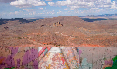 Cartography
- Autor:
- Servicio Geológico Mexicano
- Fecha de publicación:
- 26 de septiembre de 2017
La legalidad, veracidad y la calidad de la información es estricta responsabilidad de la dependencia, entidad o empresa productiva del Estado que la proporcionó en virtud de sus atribuciones y/o facultades normativas.